Brian Sperlongano
08bb2a06c0
Add network to transport layer ( #1158 )
...
Closes #1153
This PR populates the existing `network_type` field in the route table with highway route network information, using the most important value in cases of concurrencies. In order to expose this value, two files `network_type.sql` and `update_route_member.sql` were moved from the `transportation_name` layer to the `transportation` layer.
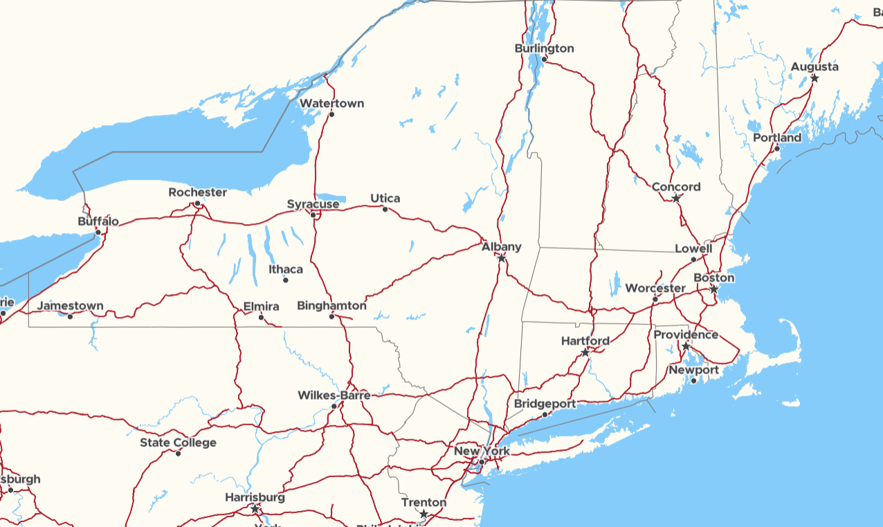
Below is a representative zoom level 6 with motorways only shown for `us-interstate` network types. This sample was generated from this PR using a [custom branch](https://github.com/ZeLonewolf/openstreetmap-americana/tree/selective-highway-zoom ) of openstreetmap-americana. This provides a simplified rendering of the highway network which excludes many minor motorway roads and sections.
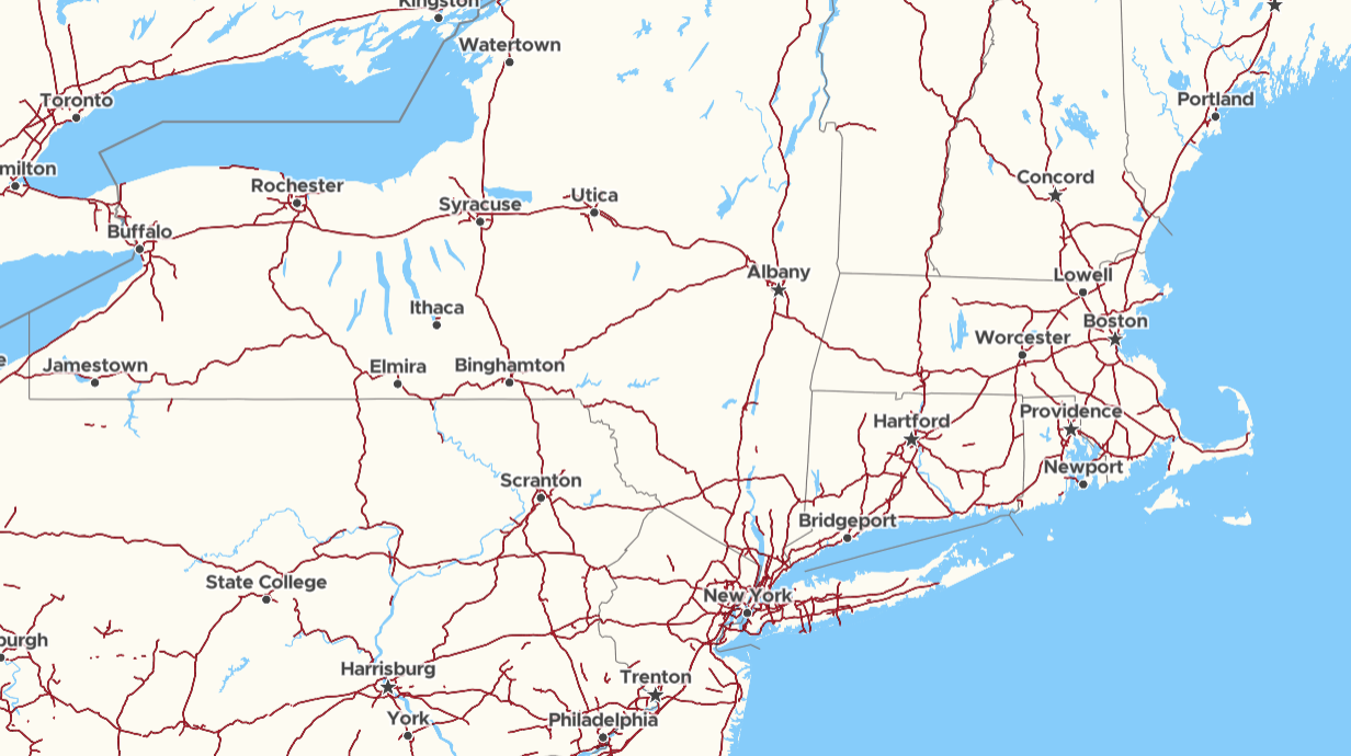
Below is zoom level 6 on the current [openstreetmap-americana](https://zelonewolf.github.io/openstreetmap-americana/#6/42.148/-73.712 ). Notice the many additional stubs, motorway islands, and minor routes which are present. Instead of rendering `highway=trunk` to make this network look nice, we can instead suppress non-interstate roads and withhold motorway+trunk rendering to a closer zoom:
2021-08-04 10:10:16 +02:00
Tomas Pohanka
d0ebdde458
Fix transportation road segments disconnection ( #1109 )
...
To avoid discontinuous transportation lines between zooms 9 and 11.
 - Originally limit geometry by length for z9 - z11 (`ST_Length(geometry) > ZRes(11)`)
 - highway z9 to z11 was generalized during import-osm
 - now just create a filtered and generalized z11 table
 - then merge segments in the same way as from (full-featured) osm_highway_linestring and used this merged z11 for mat.view z10 and z9

Close #1107
2021-04-30 15:39:56 +02:00
Adam Laža
77f5d76e37
Refactor schema, one _gen_z view per zoom. ( #1045 )
...
* Refactor layer aeroway.

* Refactor layer boundary.

* Refactor layer landcover.

* Refactor layer landuse.

* Refactor layer park.

* Refactor layer transportation.

* Refactor layer water.

* Refactor layer waterway.

* Re-generate water* layers etl_diagrams.

* Regenerate etl_diagrams for waterway.

* Cast NULL to text.
2020-11-26 13:54:00 +01:00
Eva Jelinkova
0aa6648bd9
adding brunnel into z<9 ( #1038 )
...
Following https://github.com/openmaptiles/openmaptiles/pull/1027 , solving https://github.com/openmaptiles/openmaptiles/issues/999 .
Adding brunnel attributes to merge tables of `transportation` layer, now it is possible to style/filter tunnels, bridges and fords in all zoom levels. Tested on Switzerland and Europe. Changes in generation speed and filesize minimal.
2020-11-11 15:37:09 +02:00
Adam Laža
0dc8c3256c
Rename generic layer.sql to actual_layer_name .sql ( #1034 )
...
Following layers had generic `layer.sql` name.

- `aerodrome_label`
- `aeroway`
- `housenumber`
- `mountain_peak`
- `park`
- `place`
- `poi`
- `transportation`
- `transportation_name`
- `water_name`

This PR renames `layer.sql` to `aerodrome_label.sql`, `aeroway.sql`...
2020-11-09 11:43:35 +02:00