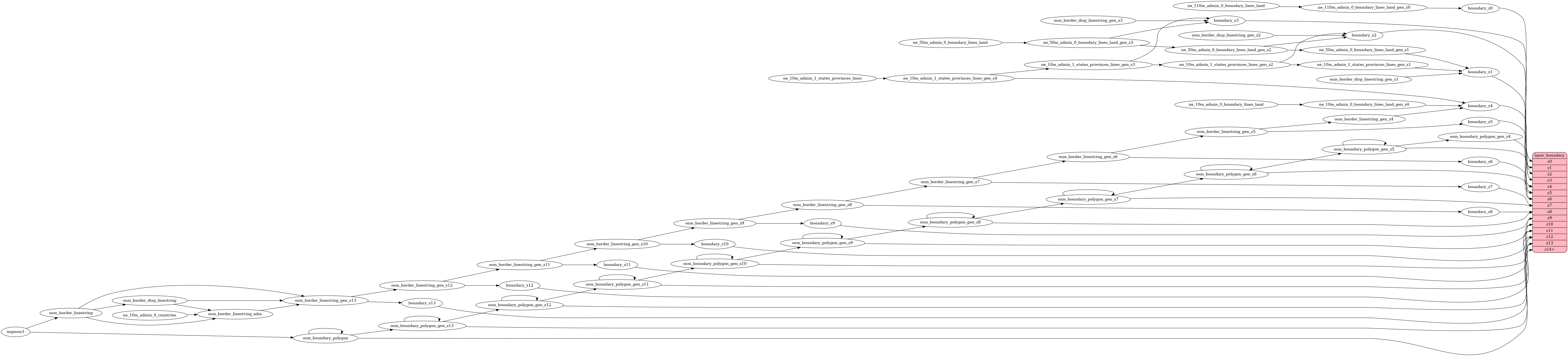
This PR fixes boundary layer at low zoom levels:

-z4 - remove maritime boundary (Peru, northern and southern end of boundary between Canada and Alaska).
-z1-z4 - do not mix disputed boundary from NE and OSM - linestrings got duplicated. Use only NE data (z0-z4), then OSM data (z5+)