This website requires JavaScript.
Explore
Help
Sign In
cerxes
/
openmaptiles
Watch
1
Star
0
Fork
0
You've already forked openmaptiles
Code
Issues
Pull Requests
Releases
Wiki
Activity
Files
13aaa404d9a5e4ff4cc6c01574dfacc35880147c
openmaptiles
/
layers
/
water_name
History
Frédéric Rodrigo
13aaa404d9
Fix More fail safe incremental update on water_lakeline and water_point (
#949
) (
#950
)
2020-07-22 12:17:33 +02:00
..
etl_diagram.png
Updated etl diagrams from latest tools
2020-02-14 16:22:48 -05:00
layer.sql
Fix & optimize incorrect function declarations (
#918
)
2020-06-17 12:15:26 -04:00
mapping_diagram.png
Add landuse=basin as water (
#876
)
2020-05-22 14:45:18 +02:00
mapping.yaml
Use one pass docs image generation (
#751
)
2020-01-22 21:55:22 -05:00
README.md
Update diagrams
2017-12-04 12:06:28 +01:00
update_marine_point.sql
NOOP: Format all layer's SQL code (
#917
)
2020-06-08 12:19:55 -04:00
update_water_lakeline.sql
Fix More fail safe incremental update on water_lakeline and water_point (
#949
) (
#950
)
2020-07-22 12:17:33 +02:00
update_water_point.sql
More fail safe incremental update on water_lakeline and water_point (
#949
)
2020-07-21 17:35:49 +02:00
water_name.yaml
Add intermittent field to water* layers (
#430
PR
#585
)
2019-05-24 13:21:43 +02:00
README.md
water_name
Docs
Read the layer documentation at
http://openmaptiles.org/schema#water_name
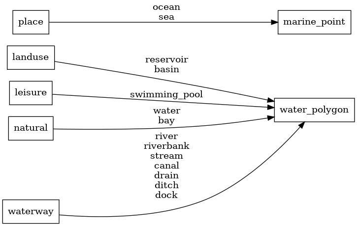
Mapping Diagram
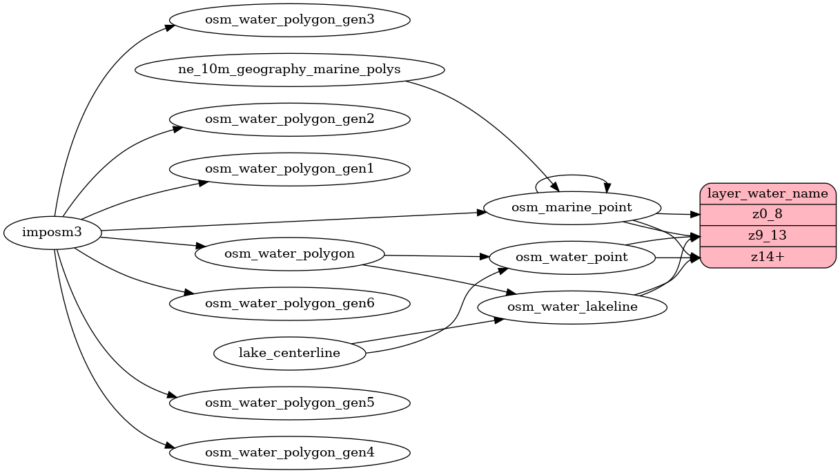
ETL diagram
Reference in New Issue
View Git Blame
Copy Permalink