Logo
Explore Help
Sign In
cerxes/openmaptiles
1
0
Fork 0
You've already forked openmaptiles
Code Issues Pull Requests Releases Wiki Activity
openmaptiles/layers/water_name
History
Tomas Pohanka 72165933be
add ST_IsValid where ST_PointOnSurface (#1025)
Same as #1015 for another ST_PointOnSurface
2020-10-13 16:28:20 +03:00
..
etl_diagram.png
Updated etl diagrams from latest tools
2020-02-14 16:22:48 -05:00
layer.sql
Remove alignment of AS in SQL and few others (#932)
2020-07-22 13:48:25 +02:00
mapping_diagram.png
Add landuse=salt_pond as water (#1000)
2020-09-29 07:53:35 +03:00
mapping.yaml
Use one pass docs image generation (#751)
2020-01-22 21:55:22 -05:00
README.md
Update diagrams
2017-12-04 12:06:28 +01:00
update_marine_point.sql
Add timers to trigger function (#1006)
2020-10-08 16:57:16 +03:00
update_water_lakeline.sql
Remove alignment of AS in SQL and few others (#932)
2020-07-22 13:48:25 +02:00
update_water_point.sql
add ST_IsValid where ST_PointOnSurface (#1025)
2020-10-13 16:28:20 +03:00
water_name.yaml
Add intermittent field to water* layers (#430 PR #585)
2019-05-24 13:21:43 +02:00

README.md

water_name

Docs

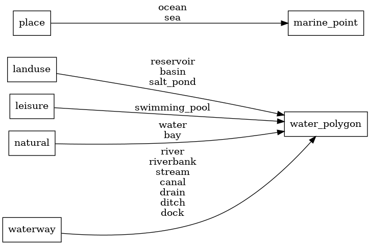
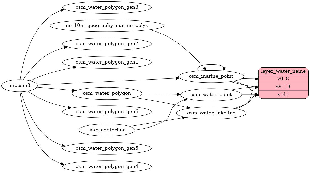
Read the layer documentation at http://openmaptiles.org/schema#water_name

Mapping Diagram

Mapping diagram for water_name

ETL diagram

ETL diagram for water_name

Powered by Gitea Version: 1.23.5 Page: 53ms Template: 3ms
English
Bahasa Indonesia Deutsch English Español Français Gaeilge Italiano Latviešu Magyar nyelv Nederlands Polski Português de Portugal Português do Brasil Suomi Svenska Türkçe Čeština Ελληνικά Български Русский Українська فارسی മലയാളം 日本語 简体中文 繁體中文(台灣) 繁體中文(香港) 한국어
Licenses API