This website requires JavaScript.
Explore
Help
Sign In
cerxes
/
openmaptiles
Watch
1
Star
0
Fork
0
You've already forked openmaptiles
Code
Issues
Pull Requests
Releases
Wiki
Activity
Files
cd5a2880e0c6fa5ee736a35bc3c6d138f637dd6b
openmaptiles
/
layers
/
transportation
History
Miel Truyen
cd5a2880e0
chore: bugfixes and notes after merging
2025-06-14 23:05:53 +02:00
..
class.sql
Add grade 1 tracks to paved (
#1485
)
2023-01-26 19:24:44 +01:00
etl_diagram.png
Add network for GBR and IRL. (
#1649
)
2024-04-02 11:08:50 +02:00
highway_name.sql
Run get_basic_name after osml10n_street_abbrev_* (
#1326
)
2021-12-08 08:20:15 +01:00
mapping_diagram.png
Add highway=bus_guideway (
#1407
)
2022-07-26 15:26:57 +02:00
mapping.yaml
[WIP] Expanded road route attributes (
#1620
)
2024-02-20 17:38:11 +01:00
network_type.sql
More roads for z4 and z5. (
#1642
)
2024-03-13 10:12:03 +01:00
README.md
Update diagrams of transportation
2017-03-15 13:55:18 +01:00
style.json
chore: bugfixes and notes after merging
2025-06-14 23:05:53 +02:00
transportation.sql
Improve getmvt performance on lower zooms (
#1704
)
2025-02-17 07:55:21 +01:00
transportation.yaml
Routes of Ireland (
#1466
)
2023-01-15 13:52:43 +01:00
update_route_member.sql
Add network for GBR and IRL. (
#1649
)
2024-04-02 11:08:50 +02:00
update_transportation_merge.sql
Set columns to null instead of dropping to avoid pg_deadlock during updates (
#1710
)
2025-02-28 13:27:52 +01:00
README.md
transportation
Docs
Read the layer documentation at
http://openmaptiles.org/schema#transportation
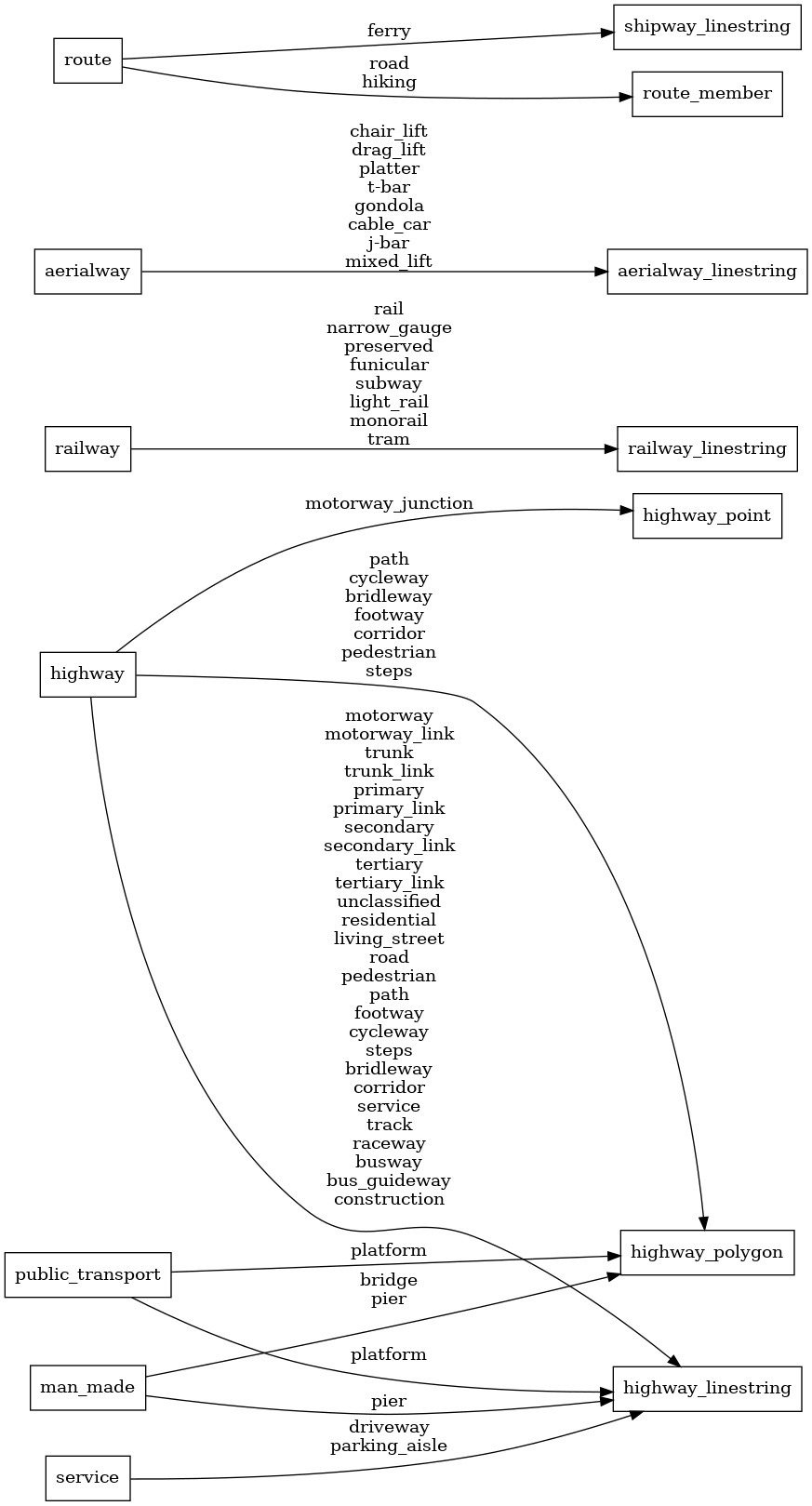
Mapping Diagram
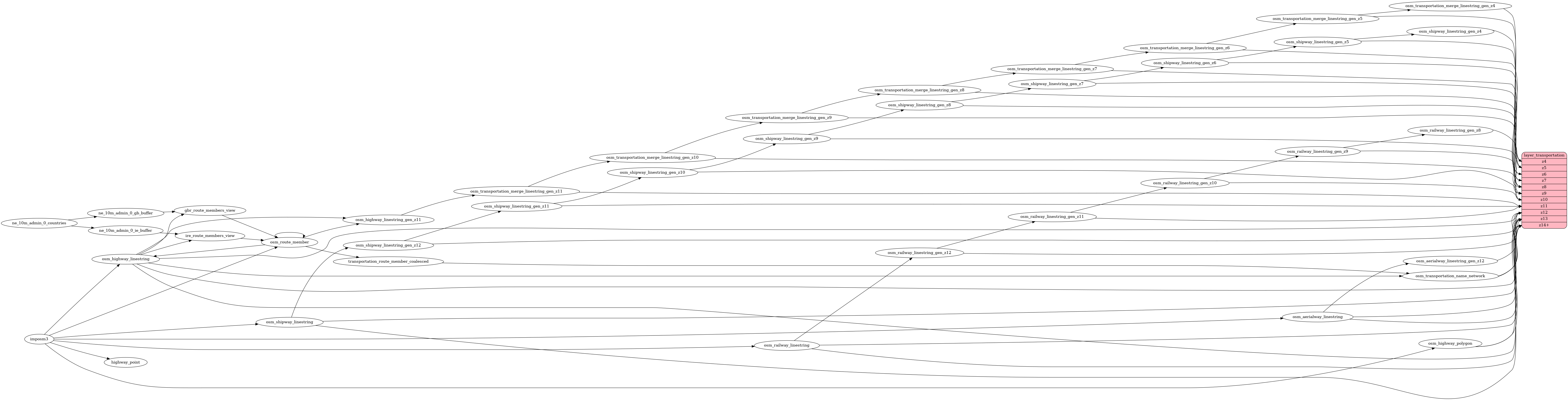
ETL diagram
Reference in New Issue
View Git Blame
Copy Permalink